2021
Ongoing
Team Project
Role l Project Lead, Research, Experience Prototyping
Ongoing
Team Project
Role l Project Lead, Research, Experience Prototyping

Over half the world's population lives in urban areas today, according to the United Nations, and that figure is expected to rise to 66% by 2050. Vertical cities offer a space-saving way to house all those people. How will this change the way we navigate?
Polaris: The North Star
Much like the actual North Star, which has served as a reliable beacon to guide mariners home, the Polaris application enables people to create, share and view 3D paths that are augmented in real time.
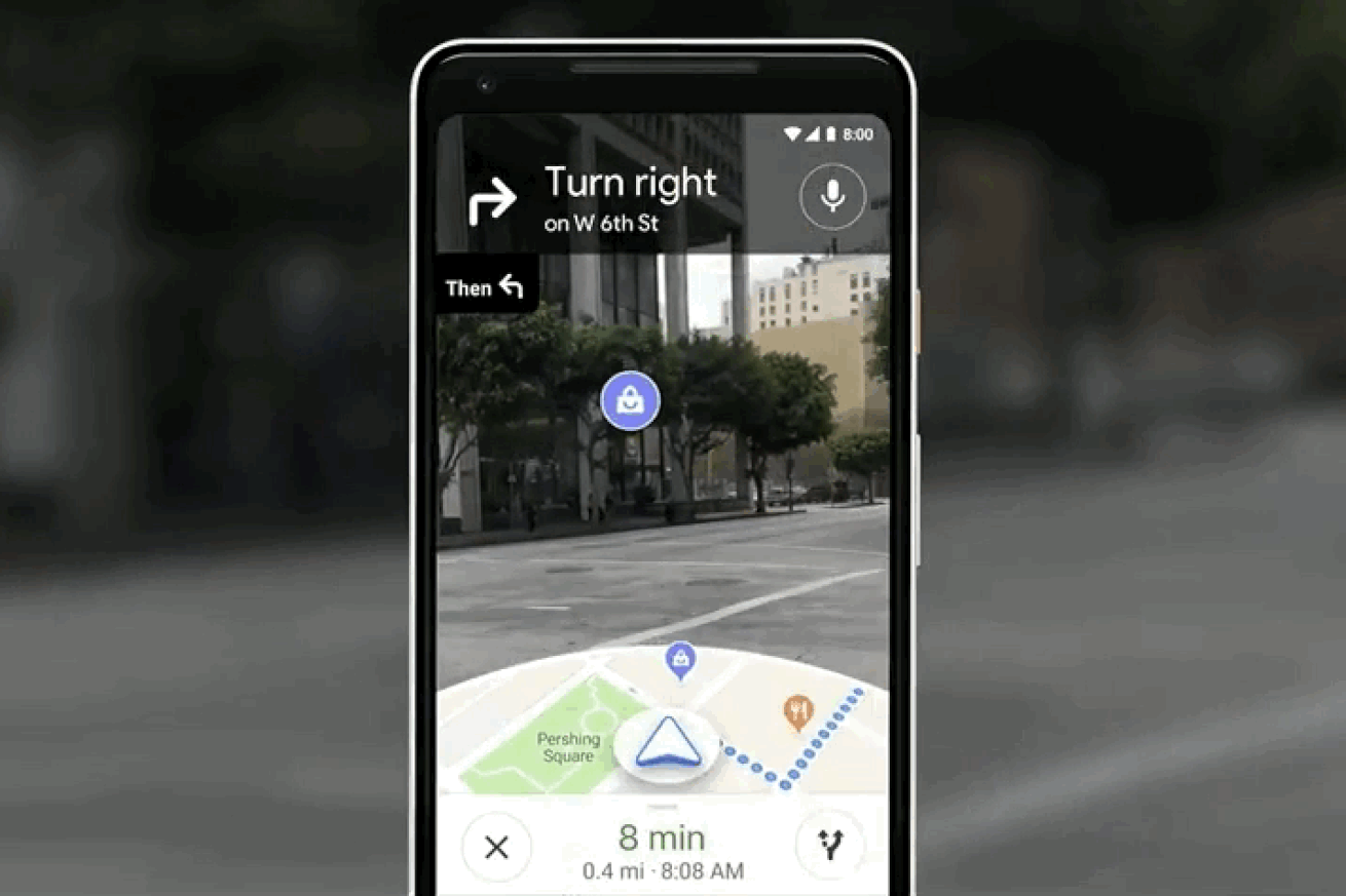
Courtesy of Google.
Current tools and platforms provide top-view or planar navigation, which cease to be helpful once an individual arrives at a destination. However, in most situations, micro-navigating vertical spaces is the real challenge, more so in a foreign setting. E.g., finding a shop in a large, new shopping mall.
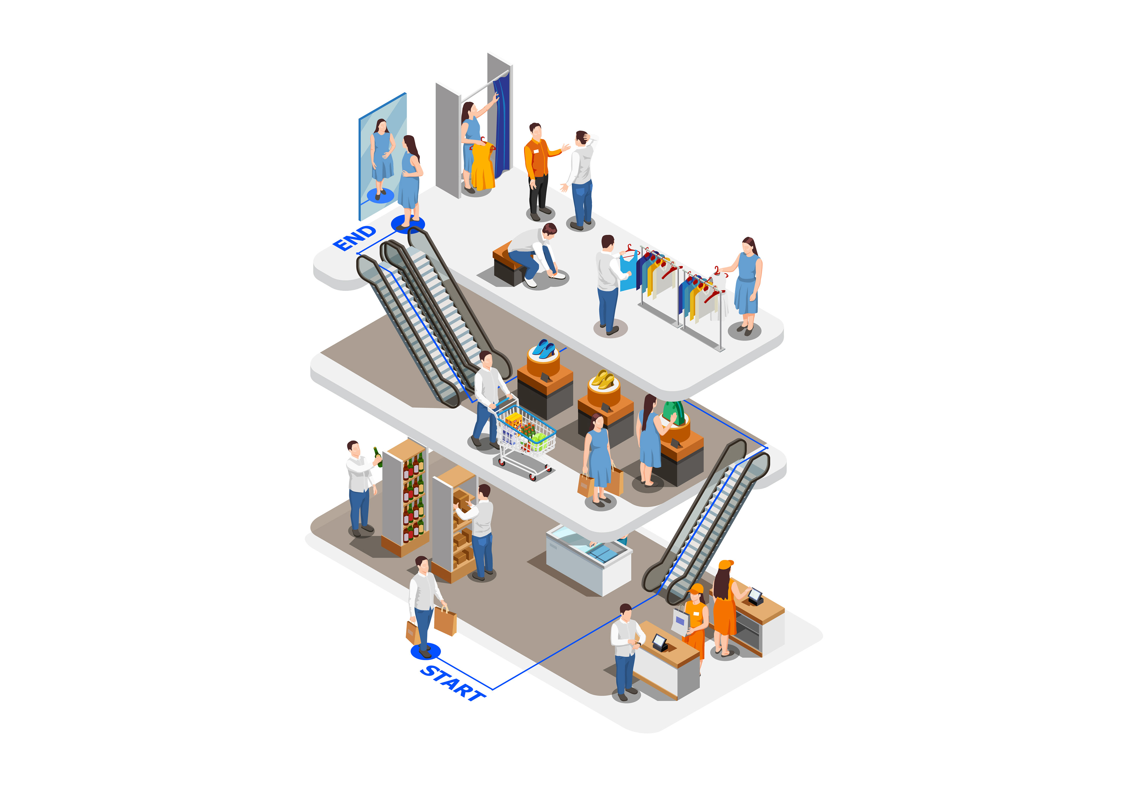
While Polaris is currently a prototype, it highlights the immense potential and value of creating and sharing routes in vertical, urban spaces. Ultimately, it anticipates the need for micro-navigation in the future and suggests new AR applications for path-finding.

The Polaris logo echoes the playful usage of lines in 3D space. The iconic navigation symbol has also been subtly integrated into the letter 'A' to hint at the the vision and purpose of the brand.
Team
Nacho Vilanova
Elijah Ko
Elijah Ko